|
|
Mapping of Contacts |
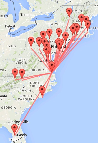
Google Maps provide an excellent means to map the location of the
NCS's Check-Ins, either by Lat/Long, or by QTH City and State. A
utility has been provided on the ECARS website (see link below) that
displays the NCS location and the Check-in locations by a small teardrop
icon and with a line connecting them, showing the line of bearing to the
Check-In. As each Check-In is entered, the distance between the NCS
and the Check-Ins is shown just above the map.
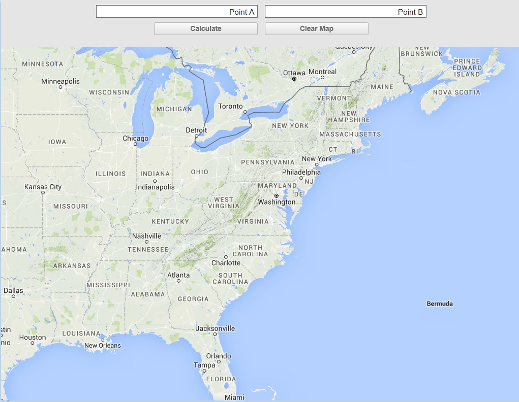
The map has a Point A input box, a Point B input
box, a Calculate Action Button, and a Clear Map Action Button. The NCS
puts his Lat/Long, or his QTH City and State in the Point A box. The
NCS then puts each Check-In QTH City and State in the Point B Box and either
hits the Enter key or clicks the Calculate Action Button. A space is
needed between the City and State in the Point A and Point B input boxes,
but no comma is expected.
Clicking the 'Clear Map' will clear all previous
data and is irreversible once done.
Google Maps provides built in support for zooming
in or out with the thumbwheel and dragging the map to recenter it. As
you zoom in on a Google Map, greater detailis provided and it can be
informative to zoom in on a new check in to see cities and sites in near
vicinity to the Check In.
Go To Google
Map Contact Mapping Utility
The Modified ECARS Logger (see NCS Logging
Software in the NCS Operations / Tool page), Version 2.0 and later, includes
an election option to display the Contact Mapping Utility and to
automatically plot the location of each Check In when the NCS completes the
Check-In process. No separate action is required by the operator to
put data into the Point A and Point B text input fields.